
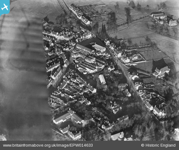
EPW014633 ENGLAND (1925). Marble Alley and environs, Studley, 1925
© Copyright OpenStreetMap contributors and licensed by the OpenStreetMap Foundation. 2024. Cartography is licensed as CC BY-SA.
Nearby Images (2)
EPW014633

EPW014632

Details
| Title | [EPW014633] Marble Alley and environs, Studley, 1925 |
| Reference | EPW014633 |
| Date | 10-December-1925 |
| Link | |
| Place name | STUDLEY |
| Parish | STUDLEY |
| District | |
| Country | ENGLAND |
| Easting / Northing | 407239, 263933 |
| Longitude / Latitude | -1.8938958485896, 52.273108488239 |
| National Grid Reference | SP072639 |
Pins
 peter stuart legat |
Saturday 4th of July 2020 09:58:25 AM | |
peter stuart legat |
Saturday 4th of July 2020 09:53:11 AM |


