
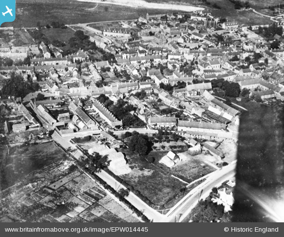
EPW014445 ENGLAND (1925). The western part of the village, Finedon, 1925. This image has been produced from a copy-negative.
© Copyright OpenStreetMap contributors and licensed by the OpenStreetMap Foundation. 2025. Cartography is licensed as CC BY-SA.
Nearby Images (2)
EPW014445

EPW014448

Details
| Title | [EPW014445] The western part of the village, Finedon, 1925. This image has been produced from a copy-negative. |
| Reference | EPW014445 |
| Date | 9-October-1925 |
| Link | |
| Place name | FINEDON |
| Parish | FINEDON |
| District | |
| Country | ENGLAND |
| Easting / Northing | 491522, 271821 |
| Longitude / Latitude | -0.65658881459923, 52.336441843248 |
| National Grid Reference | SP915718 |
Pins

Simon |
Monday 28th of April 2025 05:14:50 PM |