
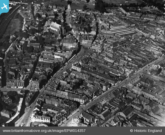
EPW014357 ENGLAND (1925). The city centre, Carlisle, 1925. This image has been produced from a print.
© Copyright OpenStreetMap contributors and licensed by the OpenStreetMap Foundation. 2026. Cartography is licensed as CC BY-SA.
Nearby Images (10)
EPW014357

EPW014374

EPW014363

EPW014351

EPW014359

EPW014370

EPW040207

EPW014373

EPW014361

EAW014518

Details
| Title | [EPW014357] The city centre, Carlisle, 1925. This image has been produced from a print. |
| Reference | EPW014357 |
| Date | 24-September-1925 |
| Link | |
| Place name | CARLISLE |
| Parish | |
| District | |
| Country | ENGLAND |
| Easting / Northing | 340138, 555876 |
| Longitude / Latitude | -2.9334478345523, 54.893944925254 |
| National Grid Reference | NY401559 |
Pins
Be the first to add a comment to this image!