
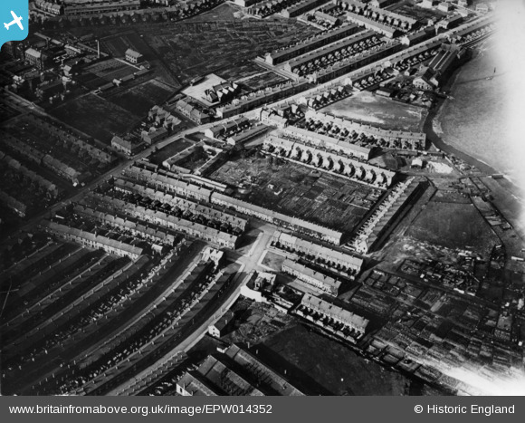
EPW014352 ENGLAND (1925). Housing around Sybil Street and environs, Carlisle, 1925. This image has been produced from a print.
© Copyright OpenStreetMap contributors and licensed by the OpenStreetMap Foundation. 2025. Cartography is licensed as CC BY-SA.
Nearby Images (3)
EPW014352

EPW040205

EPW014353

Details
| Title | [EPW014352] Housing around Sybil Street and environs, Carlisle, 1925. This image has been produced from a print. |
| Reference | EPW014352 |
| Date | 24-September-1925 |
| Link | |
| Place name | CARLISLE |
| Parish | |
| District | |
| Country | ENGLAND |
| Easting / Northing | 341169, 555334 |
| Longitude / Latitude | -2.9172627459318, 54.889196819453 |
| National Grid Reference | NY412553 |
Pins

Paul E |
Tuesday 27th of August 2019 10:23:11 AM |