
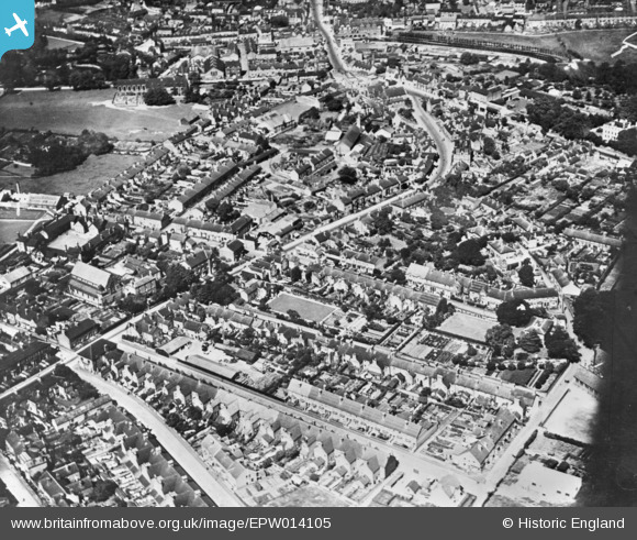
EPW014105 ENGLAND (1925). Wolverhampton Road and environs, Forebridge, 1925. This image has been produced from a copy-negative.
© Copyright OpenStreetMap contributors and licensed by the OpenStreetMap Foundation. 2026. Cartography is licensed as CC BY-SA.
Nearby Images (12)
EPW014105

EPW034023

EPW053374

EPW034020

EPW020051

EPW053857

EPW053858

EPW053860

EPW053862

EPW053859

EPW053863

EPW053861

Details
| Title | [EPW014105] Wolverhampton Road and environs, Forebridge, 1925. This image has been produced from a copy-negative. |
| Reference | EPW014105 |
| Date | August-1925 |
| Link | |
| Place name | FOREBRIDGE |
| Parish | |
| District | |
| Country | ENGLAND |
| Easting / Northing | 392396, 322605 |
| Longitude / Latitude | -2.1127978757444, 52.800617878466 |
| National Grid Reference | SJ924226 |
