
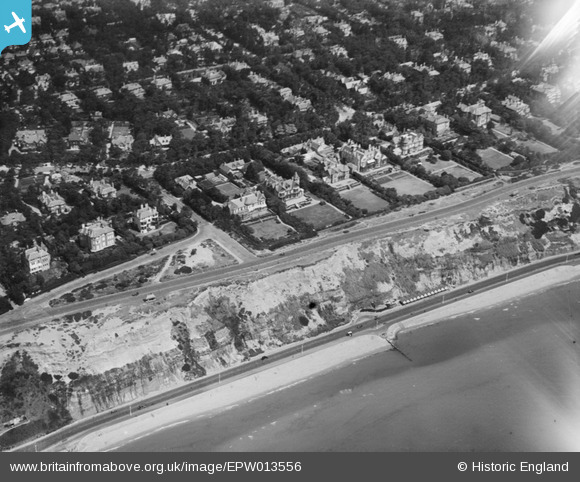
EPW013556 ENGLAND (1925). East Overcliff Drive, Bournemouth, 1925
© Copyright OpenStreetMap contributors and licensed by the OpenStreetMap Foundation. 2026. Cartography is licensed as CC BY-SA.
Nearby Images (8)
EPW013556

EAW048935

EPW061511

EAW048933

EAW048932

EAW048931

EAW048934

EAW002996

Details
| Title | [EPW013556] East Overcliff Drive, Bournemouth, 1925 |
| Reference | EPW013556 |
| Date | June-1925 |
| Link | |
| Place name | BOURNEMOUTH |
| Parish | |
| District | |
| Country | ENGLAND |
| Easting / Northing | 410200, 91121 |
| Longitude / Latitude | -1.8554948725678, 50.719052250493 |
| National Grid Reference | SZ102911 |
Pins

Sroche |
Tuesday 11th of April 2023 09:50:43 PM | |

Class31 |
Tuesday 15th of July 2014 08:17:04 AM | |
|
Class31 |
Tuesday 15th of July 2014 08:14:50 AM | |
|
Class31 |
Tuesday 15th of July 2014 08:12:39 AM | |
|
Ian |
Thursday 18th of October 2012 02:59:43 PM |


