
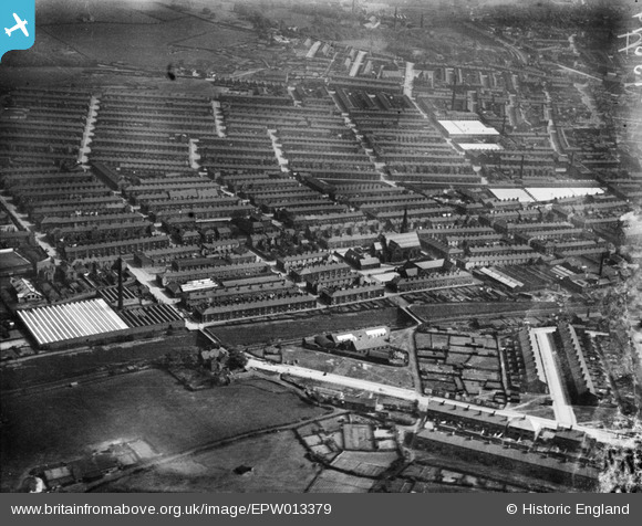
EPW013379 ENGLAND (1925). St John's Church and surrounds, Accrington, 1925
© Copyright OpenStreetMap contributors and licensed by the OpenStreetMap Foundation. 2026. Cartography is licensed as CC BY-SA.
Nearby Images (11)
EPW013379

EPW013382

EPW041929

EPW041925

EPW041924

EPW041928

EPW041930

EPW041923

EPW041927

EPW041926

EPW041931

Details
| Title | [EPW013379] St John's Church and surrounds, Accrington, 1925 |
| Reference | EPW013379 |
| Date | June-1925 |
| Link | |
| Place name | ACCRINGTON |
| Parish | |
| District | |
| Country | ENGLAND |
| Easting / Northing | 376375, 429105 |
| Longitude / Latitude | -2.3583707356398, 53.75754901897 |
| National Grid Reference | SD764291 |
Pins
Be the first to add a comment to this image!