
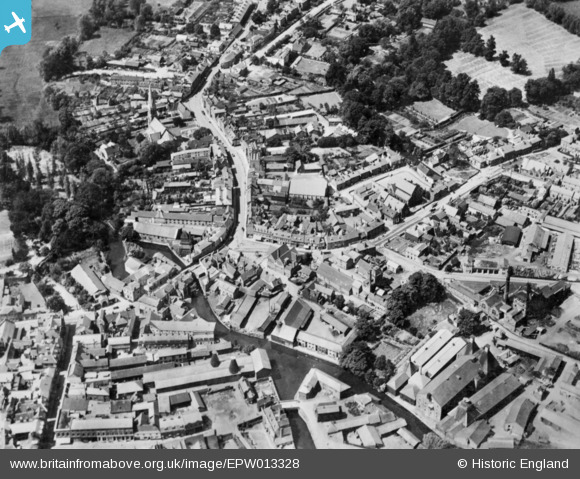
EPW013328 ENGLAND (1925). St Andrew Street and environs, Hertford, 1925. This image has been produced from a copy-negative.
© Copyright OpenStreetMap contributors and licensed by the OpenStreetMap Foundation. 2026. Cartography is licensed as CC BY-SA.
Nearby Images (8)
EPW013328

EAW022370

EAW022371

EAW022369

EPW013333

EPW022368

EAW022372

EPW013329

Details
| Title | [EPW013328] St Andrew Street and environs, Hertford, 1925. This image has been produced from a copy-negative. |
| Reference | EPW013328 |
| Date | June-1925 |
| Link | |
| Place name | HERTFORD |
| Parish | HERTFORD |
| District | |
| Country | ENGLAND |
| Easting / Northing | 532432, 212691 |
| Longitude / Latitude | -0.079343353015979, 51.796717583499 |
| National Grid Reference | TL324127 |
Pins
Be the first to add a comment to this image!