
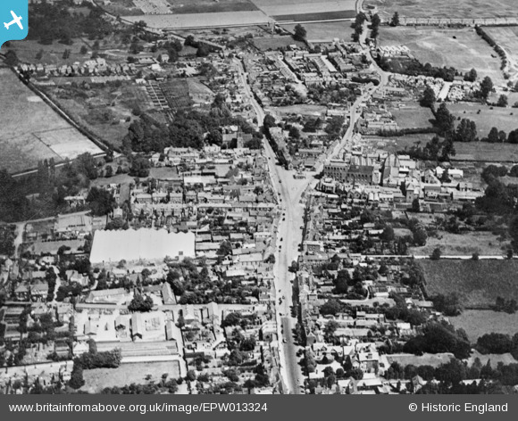
EPW013324 ENGLAND (1925). The town centre, Hoddesdon, 1925. This image has been produced from a copy-negative.
© Copyright OpenStreetMap contributors and licensed by the OpenStreetMap Foundation. 2026. Cartography is licensed as CC BY-SA.
Nearby Images (8)
EPW013324

EPW025945

EPW025940

EPW025938

EPW025944

EPW025942

EPW025939

EPW013322

Details
| Title | [EPW013324] The town centre, Hoddesdon, 1925. This image has been produced from a copy-negative. |
| Reference | EPW013324 |
| Date | June-1925 |
| Link | |
| Place name | HODDESDON |
| Parish | |
| District | |
| Country | ENGLAND |
| Easting / Northing | 537294, 208811 |
| Longitude / Latitude | -0.010409768978389, 51.760676829982 |
| National Grid Reference | TL373088 |
Pins

Colin |
Thursday 1st of August 2024 01:54:15 PM | |
|
Colin |
Monday 7th of August 2017 12:57:17 PM | |
|
Colin |
Monday 7th of August 2017 12:56:06 PM | |
|
Colin |
Monday 7th of August 2017 12:55:19 PM | |
|
canty |
Tuesday 14th of February 2017 08:58:51 PM |