
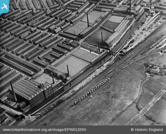
EPW013260 ENGLAND (1925). Cotton mills on the Leeds and Liverpool Canal, Burnley, 1925
© Copyright OpenStreetMap contributors and licensed by the OpenStreetMap Foundation. 2026. Cartography is licensed as CC BY-SA.
Nearby Images (8)
EPW013260

EPW013175

EPW025190

EPW025191

EPW025128

EPW025187

EPW025189

EPW025129

Details
| Title | [EPW013260] Cotton mills on the Leeds and Liverpool Canal, Burnley, 1925 |
| Reference | EPW013260 |
| Date | June-1925 |
| Link | |
| Place name | BURNLEY |
| Parish | |
| District | |
| Country | ENGLAND |
| Easting / Northing | 384041, 433835 |
| Longitude / Latitude | -2.2423304078748, 53.800358029389 |
| National Grid Reference | SD840338 |
Pins
Be the first to add a comment to this image!

