
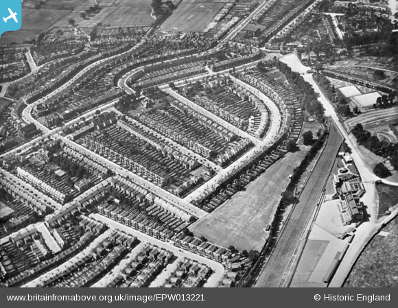
EPW013221 ENGLAND (1925). Redston Road and environs, Muswell Hill, 1925. This image has been produced from a copy-negative.
© Copyright OpenStreetMap contributors and licensed by the OpenStreetMap Foundation. 2026. Cartography is licensed as CC BY-SA.
Nearby Images (2)
EPW013221

EPW046816

Details
| Title | [EPW013221] Redston Road and environs, Muswell Hill, 1925. This image has been produced from a copy-negative. |
| Reference | EPW013221 |
| Date | June-1925 |
| Link | |
| Place name | MUSWELL HILL |
| Parish | |
| District | |
| Country | ENGLAND |
| Easting / Northing | 529683, 189418 |
| Longitude / Latitude | -0.12784108560516, 51.588198476639 |
| National Grid Reference | TQ297894 |
