
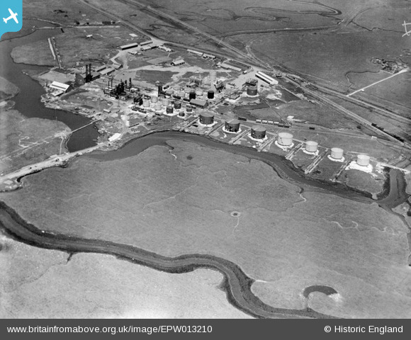
EPW013210 ENGLAND (1925). The Medway Oil Storage Company Ltd, Isle of Grain, 1925
© Copyright OpenStreetMap contributors and licensed by the OpenStreetMap Foundation. 2026. Cartography is licensed as CC BY-SA.
Nearby Images (5)
EPW013210

EPW013211

EPW013202

EPW013207

EPW013203

Details
| Title | [EPW013210] The Medway Oil Storage Company Ltd, Isle of Grain, 1925 |
| Reference | EPW013210 |
| Date | June-1925 |
| Link | |
| Place name | ISLE OF GRAIN |
| Parish | ISLE OF GRAIN |
| District | |
| Country | ENGLAND |
| Easting / Northing | 586323, 175015 |
| Longitude / Latitude | 0.68140533208537, 51.442942172195 |
| National Grid Reference | TQ863750 |
Pins

Kentishman |
Friday 22nd of July 2016 11:12:34 AM | |
|
Kentishman |
Monday 27th of July 2015 09:04:04 PM |