
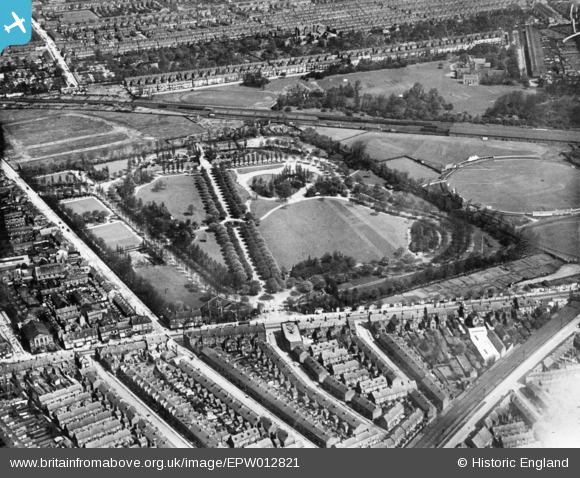
EPW012821 ENGLAND (1925). West Park, Kingston upon Hull, 1925. This image has been produced from a print.
© Copyright OpenStreetMap contributors and licensed by the OpenStreetMap Foundation. 2026. Cartography is licensed as CC BY-SA.
Nearby Images (6)
EPW012821

EPW036556

EPW036568

EPW012816

EPW036391

EPW036553

Details
| Title | [EPW012821] West Park, Kingston upon Hull, 1925. This image has been produced from a print. |
| Reference | EPW012821 |
| Date | May-1925 |
| Link | |
| Place name | KINGSTON UPON HULL |
| Parish | |
| District | |
| Country | ENGLAND |
| Easting / Northing | 507520, 428907 |
| Longitude / Latitude | -0.36942989420549, 53.745213358658 |
| National Grid Reference | TA075289 |
Pins

John Wass |
Wednesday 14th of August 2019 07:37:13 PM | |
|
John Wass |
Thursday 27th of June 2019 02:19:48 PM | |
|
John Wass |
Thursday 27th of June 2019 02:18:49 PM | |
|
John Wass |
Thursday 27th of June 2019 02:17:11 PM | |
|
John Wass |
Friday 21st of November 2014 09:18:04 PM |