
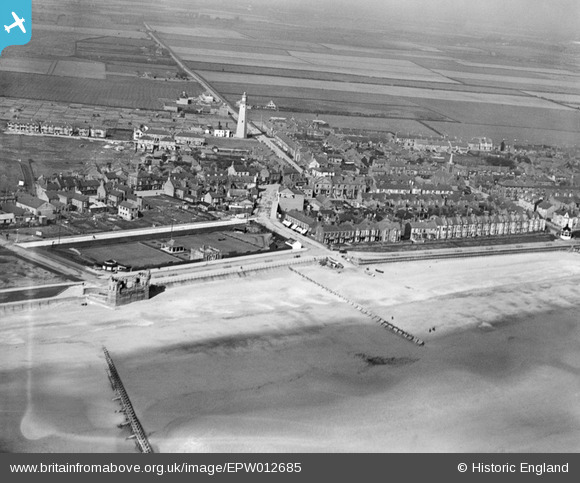
EPW012685 ENGLAND (1925). The Promenade and Lighthouse, Withernsea, 1925
© Copyright OpenStreetMap contributors and licensed by the OpenStreetMap Foundation. 2026. Cartography is licensed as CC BY-SA.
Nearby Images (3)
EPW012685

EPW012682

EAW013979

Details
| Title | [EPW012685] The Promenade and Lighthouse, Withernsea, 1925 |
| Reference | EPW012685 |
| Date | 6-May-1925 |
| Link | |
| Place name | WITHERNSEA |
| Parish | WITHERNSEA |
| District | |
| Country | ENGLAND |
| Easting / Northing | 534259, 428021 |
| Longitude / Latitude | 0.035435924283821, 53.731053831955 |
| National Grid Reference | TA343280 |
Pins

43s flyer |
Tuesday 24th of February 2026 01:20:36 PM | |
|
lipsee |
Sunday 28th of April 2019 01:16:24 AM | |
|
lipsee |
Thursday 30th of August 2018 09:15:58 AM | |
|
lipsee |
Friday 25th of September 2015 11:15:47 AM | |
|
lipsee |
Friday 25th of September 2015 10:15:57 AM | |
There is a realistic possibility that it is a wind pump for a well at the school. Houses on Arthur Street and Bannister Street at the very least had wells. |
NickH |
Thursday 16th of May 2019 07:44:13 PM |
|
John Wass |
Friday 3rd of July 2015 08:18:17 PM |
User Comment Contributions
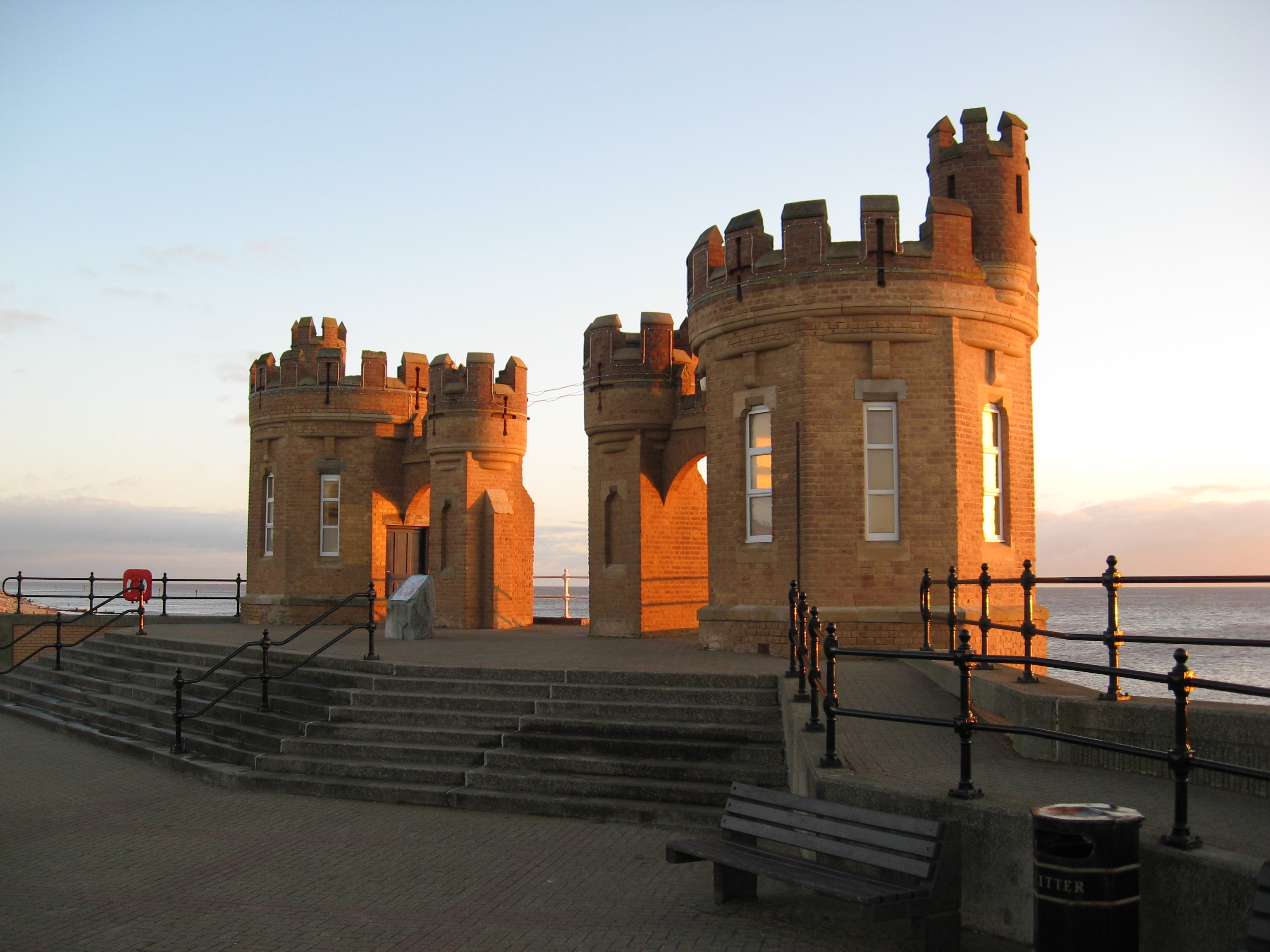
This is a recent photo of the Pier Towers seen in the bottom left of the aerial picture |
EAST COASTER |
Tuesday 26th of June 2012 07:57:54 PM |