
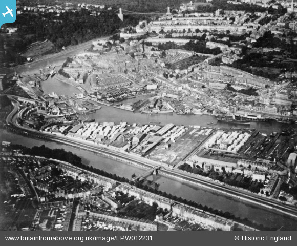
EPW012231 ENGLAND (1924). The River Avon (New Cut), the Floating Harbour and Hotwells, Bristol, 1924. This image has been produced from a copy-negative.
© Copyright OpenStreetMap contributors and licensed by the OpenStreetMap Foundation. 2026. Cartography is licensed as CC BY-SA.
Nearby Images (9)
EPW012231
, the Floating Harbour and Hotwells, Bristol, 1924. This image has been produced from a copy-negative.")
EAW002051

EPW012015

EAW002050

EPW005470

EAW033322

EAW033316
 moored off Hotwell Road, Bristol, 1950")
EPW033497

EAW033326

Details
| Title | [EPW012231] The River Avon (New Cut), the Floating Harbour and Hotwells, Bristol, 1924. This image has been produced from a copy-negative. |
| Reference | EPW012231 |
| Date | October-1924 |
| Link | |
| Place name | BRISTOL |
| Parish | |
| District | |
| Country | ENGLAND |
| Easting / Northing | 357322, 172327 |
| Longitude / Latitude | -2.6142045485771, 51.447830555909 |
| National Grid Reference | ST573723 |
Pins

Hotwellian |
Wednesday 8th of June 2022 05:55:14 PM |