
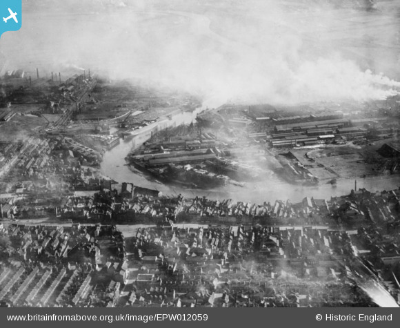
EPW012059 ENGLAND (1924). Thornaby Shipbuilding Yard and the Market Place, Stockton-on-Tees, from the west, 1924. This image has been produced from a copy-negative.
© Copyright OpenStreetMap contributors and licensed by the OpenStreetMap Foundation. 2026. Cartography is licensed as CC BY-SA.
Nearby Images (5)
EPW012059

EAW013852

EPW010140

EPW010139

EPW010267

Details
| Title | [EPW012059] Thornaby Shipbuilding Yard and the Market Place, Stockton-on-Tees, from the west, 1924. This image has been produced from a copy-negative. |
| Reference | EPW012059 |
| Date | September-1924 |
| Link | |
| Place name | STOCKTON-ON-TEES |
| Parish | |
| District | |
| Country | ENGLAND |
| Easting / Northing | 444529, 518942 |
| Longitude / Latitude | -1.3112738724982, 54.563621767708 |
| National Grid Reference | NZ445189 |
Pins

J May |
Friday 29th of May 2015 02:06:05 PM | |
|
J May |
Friday 29th of May 2015 02:04:27 PM | |
|
J May |
Friday 29th of May 2015 02:00:25 PM | |
|
J May |
Friday 29th of May 2015 01:59:03 PM | |
|
J May |
Friday 29th of May 2015 01:51:48 PM |