
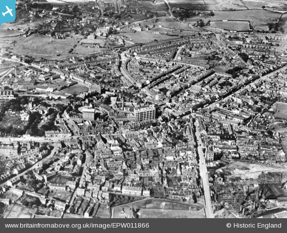
EPW011866 ENGLAND (1924). The town centre, Brierley Hill, 1924. This image has been produced from a copy-negative.
© Copyright OpenStreetMap contributors and licensed by the OpenStreetMap Foundation. 2026. Cartography is licensed as CC BY-SA.
Nearby Images (2)
EPW011866

EPW035941

Details
| Title | [EPW011866] The town centre, Brierley Hill, 1924. This image has been produced from a copy-negative. |
| Reference | EPW011866 |
| Date | September-1924 |
| Link | |
| Place name | BRIERLEY HILL |
| Parish | |
| District | |
| Country | ENGLAND |
| Easting / Northing | 391801, 286992 |
| Longitude / Latitude | -2.1207392369713, 52.480421822485 |
| National Grid Reference | SO918870 |
Pins

SirSmilerIV |
Sunday 28th of April 2024 12:52:49 PM | |
|
SirSmilerIV |
Sunday 28th of April 2024 12:51:28 PM | |
|
SirSmilerIV |
Sunday 28th of April 2024 12:50:27 PM | |
|
SirSmilerIV |
Saturday 9th of May 2020 12:40:28 PM | |
|
kennal |
Thursday 29th of September 2016 01:14:59 PM | |

black country history hunter |
Monday 11th of April 2016 01:27:21 AM | |
amazing |
mal |
Monday 31st of July 2023 10:54:28 PM |
|
black country history hunter |
Monday 11th of April 2016 01:23:27 AM |