
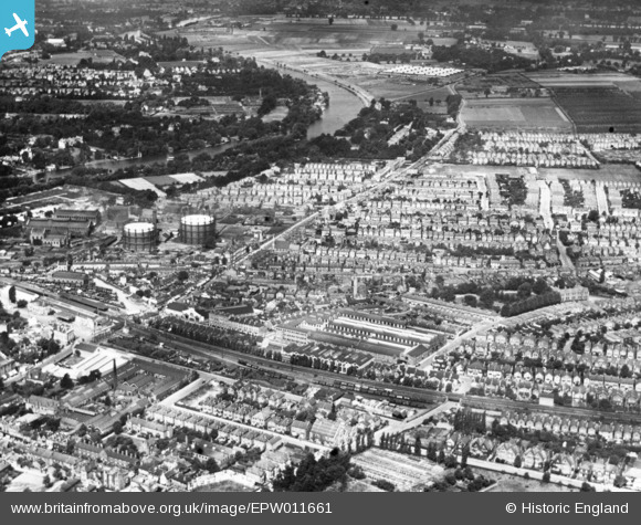
EPW011661 ENGLAND (1924). Richmond Road and environs, Kingston Upon Thames, 1924. This image has been produced from a print.
© Copyright OpenStreetMap contributors and licensed by the OpenStreetMap Foundation. 2026. Cartography is licensed as CC BY-SA.
Nearby Images (3)
EPW011661

EPW053661

EPW011662

Details
| Title | [EPW011661] Richmond Road and environs, Kingston Upon Thames, 1924. This image has been produced from a print. |
| Reference | EPW011661 |
| Date | August-1924 |
| Link | |
| Place name | KINGSTON UPON THAMES |
| Parish | |
| District | |
| Country | ENGLAND |
| Easting / Northing | 518306, 169858 |
| Longitude / Latitude | -0.29856378587027, 51.414887219609 |
| National Grid Reference | TQ183699 |
Pins

UPONTHAMES |
Saturday 26th of October 2024 08:49:25 PM | |
|
UPONTHAMES |
Friday 26th of May 2023 10:14:34 PM | |
|
KiwiMike |
Wednesday 27th of February 2019 10:19:49 PM | |
|
John Saunders |
Monday 6th of April 2015 09:56:02 AM |