
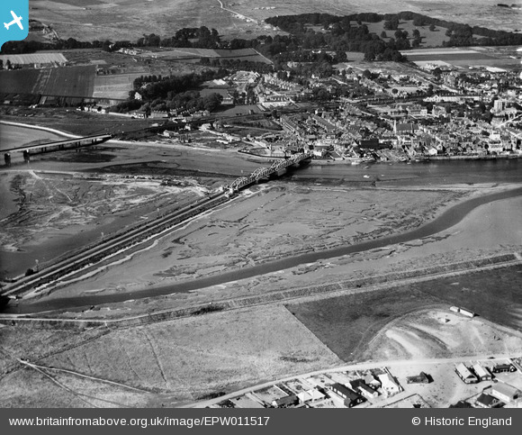
EPW011517 ENGLAND (1924). The Norfolk Bridge and view of the town, Shoreham-by-Sea, 1924
© Copyright OpenStreetMap contributors and licensed by the OpenStreetMap Foundation. 2026. Cartography is licensed as CC BY-SA.
Nearby Images (2)
EPW011517

EPW017758

Details
| Title | [EPW011517] The Norfolk Bridge and view of the town, Shoreham-by-Sea, 1924 |
| Reference | EPW011517 |
| Date | July-1924 |
| Link | |
| Place name | SHOREHAM-BY-SEA |
| Parish | |
| District | |
| Country | ENGLAND |
| Easting / Northing | 521210, 104954 |
| Longitude / Latitude | -0.27864697919282, 50.83085331766 |
| National Grid Reference | TQ212050 |
Pins

Alan McFaden |
Monday 2nd of December 2013 08:29:57 PM | |
|
Alan McFaden |
Monday 2nd of December 2013 08:27:14 PM | |
|
Alan McFaden |
Saturday 16th of November 2013 05:37:57 PM |


