
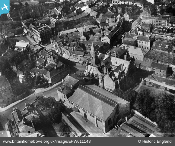
EPW011148 ENGLAND (1924). The Town Hall and Market, Trowbridge, 1924
© Copyright OpenStreetMap contributors and licensed by the OpenStreetMap Foundation. 2026. Cartography is licensed as CC BY-SA.
Nearby Images (10)
EPW011148

EPW011147

EPW014684

EAW028646

EAW028648

EPW033204

EPW033294

EPW011146

EPW033207

EAW028645

Details
| Title | [EPW011148] The Town Hall and Market, Trowbridge, 1924 |
| Reference | EPW011148 |
| Date | July-1924 |
| Link | |
| Place name | TROWBRIDGE |
| Parish | TROWBRIDGE |
| District | |
| Country | ENGLAND |
| Easting / Northing | 385667, 157910 |
| Longitude / Latitude | -2.2056983682129, 51.319611145918 |
| National Grid Reference | ST857579 |


