
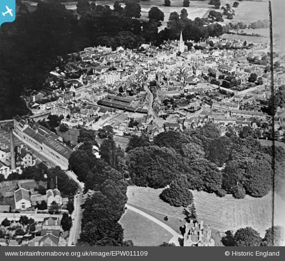
EPW011109 ENGLAND (1924). The town centre, Chippenham, 1924. This image has been produced from a copy-negative.
© Copyright OpenStreetMap contributors and licensed by the OpenStreetMap Foundation. 2026. Cartography is licensed as CC BY-SA.
Nearby Images (7)
EPW011109

EAW034910

EPW011111

EAW034912

EPW011108

EAW034909

EPW011106

Details
| Title | [EPW011109] The town centre, Chippenham, 1924. This image has been produced from a copy-negative. |
| Reference | EPW011109 |
| Date | July-1924 |
| Link | |
| Place name | CHIPPENHAM |
| Parish | CHIPPENHAM |
| District | |
| Country | ENGLAND |
| Easting / Northing | 391948, 173247 |
| Longitude / Latitude | -2.1159055341478, 51.457655185248 |
| National Grid Reference | ST919732 |
Pins
Be the first to add a comment to this image!