
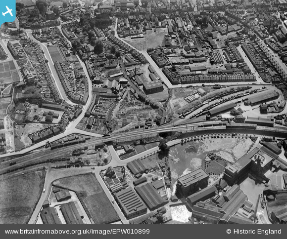
EPW010899 ENGLAND (1924). The town centre, Dartford, 1924
© Copyright OpenStreetMap contributors and licensed by the OpenStreetMap Foundation. 2026. Cartography is licensed as CC BY-SA.
Nearby Images (14)
EPW010899

EPR000349

EPW010897

EAW001403

EPR000366

EAW001394

EPW006256

EPW021978

EPW057057

EPW028227

EPW028238

EPW061008

EAW048626

EAW048627

Details
| Title | [EPW010899] The town centre, Dartford, 1924 |
| Reference | EPW010899 |
| Date | June-1924 |
| Link | |
| Place name | DARTFORD |
| Parish | |
| District | |
| Country | ENGLAND |
| Easting / Northing | 554427, 174295 |
| Longitude / Latitude | 0.22248001532822, 51.446069393641 |
| National Grid Reference | TQ544743 |
Pins

andy |
Tuesday 1st of January 2019 02:14:53 PM | |
|
JAM |
Sunday 12th of February 2017 10:23:26 PM | |
|
alastair wallace |
Saturday 21st of November 2015 12:37:57 AM | |

Barney |
Sunday 1st of February 2015 10:35:17 AM | |
|
Barney |
Sunday 1st of February 2015 10:34:39 AM | |
|
Barney |
Sunday 1st of February 2015 10:33:23 AM | |
|
Barney |
Sunday 1st of February 2015 10:32:28 AM | |
|
Barney |
Sunday 1st of February 2015 10:31:58 AM | |
|
Barney |
Sunday 1st of February 2015 10:30:08 AM |