
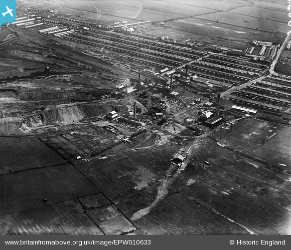
EPW010633 ENGLAND (1924). The Ashington Colliery and environs, Ashington, 1924
© Copyright OpenStreetMap contributors and licensed by the OpenStreetMap Foundation. 2026. Cartography is licensed as CC BY-SA.
Nearby Images (5)
EPW010633

EPW010629

EPW010631

EPW010632

EPW010630

Details
| Title | [EPW010633] The Ashington Colliery and environs, Ashington, 1924 |
| Reference | EPW010633 |
| Date | 14-June-1924 |
| Link | |
| Place name | ASHINGTON |
| Parish | ASHINGTON |
| District | |
| Country | ENGLAND |
| Easting / Northing | 426455, 588151 |
| Longitude / Latitude | -1.584462394488, 55.186882958014 |
| National Grid Reference | NZ265882 |
Pins

Rob McGinley |
Friday 1st of October 2021 07:49:59 PM | |
|
Rob McGinley |
Friday 1st of October 2021 07:48:27 PM | |
|
Rob McGinley |
Friday 1st of October 2021 07:47:34 PM | |
|
Rob McGinley |
Friday 1st of October 2021 07:46:41 PM | |
|
Rob McGinley |
Friday 1st of October 2021 07:45:40 PM |