
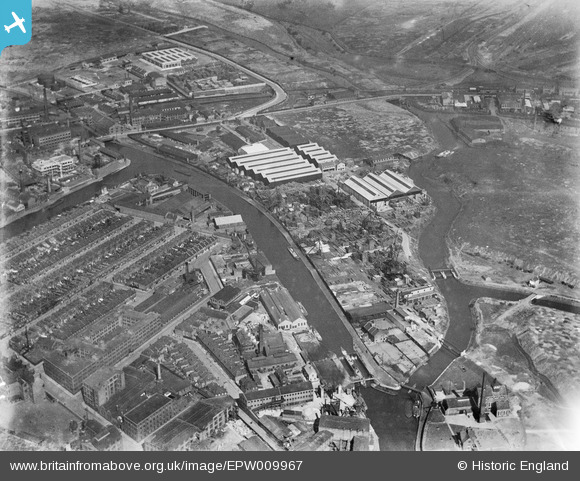
EPW009967 ENGLAND (1924). Timber yards beside the Hackney Cut Navigation, Bow, 1924
© Copyright OpenStreetMap contributors and licensed by the OpenStreetMap Foundation. 2026. Cartography is licensed as CC BY-SA.
Nearby Images (11)
EPW009967

EPW009966

EAW022426

EAW022425

EPW009968

EAW022431

EAW022429

EAW022430

EAW022427

EAW022428

EPW009965

Details
| Title | [EPW009967] Timber yards beside the Hackney Cut Navigation, Bow, 1924 |
| Reference | EPW009967 |
| Date | March-1924 |
| Link | |
| Place name | BOW |
| Parish | |
| District | |
| Country | ENGLAND |
| Easting / Northing | 537385, 184193 |
| Longitude / Latitude | -0.018763940201413, 51.539415754546 |
| National Grid Reference | TQ374842 |
Pins

Maurice |
Friday 18th of October 2013 06:44:07 AM | |

Chelsea61 |
Wednesday 5th of June 2013 11:00:14 PM |