
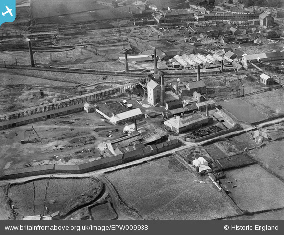
EPW009938 ENGLAND (1924). New Cook's Kitchen Mine and Iron Foundry, Redruth, 1924
© Copyright OpenStreetMap contributors and licensed by the OpenStreetMap Foundation. 2026. Cartography is licensed as CC BY-SA.
Nearby Images (7)
EPW009938

EAW033642

EAW033644

EPW059588

EAW033643

EPW009935

EPW059668

Details
| Title | [EPW009938] New Cook's Kitchen Mine and Iron Foundry, Redruth, 1924 |
| Reference | EPW009938 |
| Date | March-1924 |
| Link | |
| Place name | REDRUTH |
| Parish | CARN BREA |
| District | |
| Country | ENGLAND |
| Easting / Northing | 166462, 40940 |
| Longitude / Latitude | -5.2743629926633, 50.221659974355 |
| National Grid Reference | SW665409 |
Pins
Be the first to add a comment to this image!