
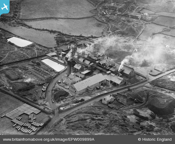
EPW009899A ENGLAND (1924). East Wheal Basset Smelting Works, Redruth, 1924
© Copyright OpenStreetMap contributors and licensed by the OpenStreetMap Foundation. 2025. Cartography is licensed as CC BY-SA.
Nearby Images (7)
EPW009899A

EPW009898

EPW009900

EPW009897

EPW009896

EPW009895

EPW009899

Details
| Title | [EPW009899A] East Wheal Basset Smelting Works, Redruth, 1924 |
| Reference | EPW009899A |
| Date | March-1924 |
| Link | |
| Place name | REDRUTH |
| Parish | REDRUTH |
| District | |
| Country | ENGLAND |
| Easting / Northing | 169437, 40131 |
| Longitude / Latitude | -5.232230897275, 50.215562175459 |
| National Grid Reference | SW694401 |
Pins
Be the first to add a comment to this image!