
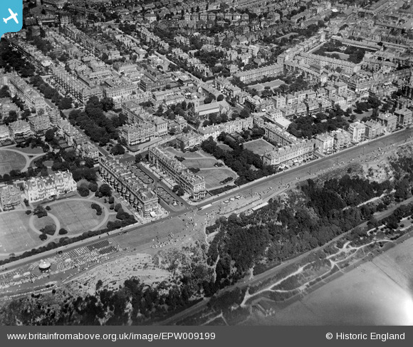
EPW009199 ENGLAND (1923). The Langhorne Gardens and The Leas, Folkestone, 1923
© Copyright OpenStreetMap contributors and licensed by the OpenStreetMap Foundation. 2026. Cartography is licensed as CC BY-SA.
Nearby Images (17)
EPW009199

EAW002857

EAW002856

EAW002855

EAW002868

EAW024827

EPW000074

EAW024830

EPW009197

EPW035414

EAW002370

EAW002867

EAW002854

EPW000364

EPW000588

EAW024828

EPW009201

Details
| Title | [EPW009199] The Langhorne Gardens and The Leas, Folkestone, 1923 |
| Reference | EPW009199 |
| Date | 1923 |
| Link | |
| Place name | FOLKESTONE |
| Parish | FOLKESTONE |
| District | |
| Country | ENGLAND |
| Easting / Northing | 622378, 135612 |
| Longitude / Latitude | 1.1749940002742, 51.07613897426 |
| National Grid Reference | TR224356 |
Pins
Be the first to add a comment to this image!