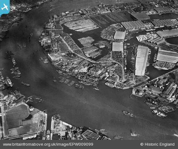
EPW009099 ENGLAND (1923). Surrey Commercial Docks, Rotherhithe, 1923

© Copyright OpenStreetMap contributors and licensed by the OpenStreetMap Foundation. 2024. Cartography is licensed as CC BY-SA.

Nearby Images (12)

EPW009099
  0° 0m
EPW009338
  189° 43m
EPW009114
  226° 45m
EPW009340
  209° 73m
EPW009339
  223° 77m
EAW045699
  238° 100m
EAW045703
  224° 149m
EAW045702
  213° 161m
EAW045698
  236° 167m
EAW045700
  225° 177m
EAW045704
  226° 186m
EAW045701
  214° 187m

Details

Title [EPW009099] Surrey Commercial Docks, Rotherhithe, 1923
Reference EPW009099
Date 1923
Link
Place name ROTHERHITHE
Parish
District
Country ENGLAND
Easting / Northing 535755, 180365
Longitude / Latitude -0.043730614989974, 51.505407120822
National Grid Reference TQ358804

Pins

River Ambulance Service (RAS), South Wharf Receiving Station, Rotherhithe Street, SE16. One of the Metropolitan Asylums Board's three locations (the other two were at Poplar and Fulham) in London to which smallpox victims would be brought during the epidemic at the turn of the 19th and 20th Centuries, for onward transport by its RAS ambulance ships ('Red Cross', 'White Cross', 'Geneva Cross', 'Albert Victor' and 'Maltese Cross') to Dartford. Three hospital ships were moored off Dartford marshes from 1882, (Atlas [men's wards], Endymion [administration, kitchen and laundry] and Castalia [women's wards]) being replaced by the Long Reach Hospital on adjacent land in 1902. The ships were taken out of service, disinfected and sold in 1904. After the smallpox epidemic, South Wharf Receiving Station and the RAS ships were used for patients with highly infections diseases such as diphtheria until the 1930s when replaced by road transport. See images EPW009100, EPW001410, EPW046833, EPW045557 & EPW024256. Lost Hospitals of London - https://ezitis.myzen.co.uk/southwharf.html http://dartfordhospitalhistories.org.uk/long-reach/long-reach-introduction/ for a photograph of the three original hospital ships - https://iiif.wellcomecollection.org/image/L0006809EB.jpg/full/full/0/default.jpg and for two photographs of the entrance to South Wharf - https://wellcomecollection.org/images?query=South+Wharf

Kentishman
Friday 23rd of July 2021 05:09:22 PM
Horn Steps and Cuckold's Point - the Pool of London's eastern or downstream limit. This stretch of the Thames up to London Bridge was the old heart of dockland, prior to the expansion of the docks eastward from 1799 when the construction of the West India Docks on the Isle of Dogs was authorised by Act of Parliament. The work was completed in 1802. As tall ships could not pass under London Bridge, this was the natural western limit of the Pool of London. See: http://www.pla.co.uk/Port-Trade/History-of-the-Port-of-London-pre-1908#18 Horn Steps were the southern end of the Limehouse Hole ferry the ran the Limehouse Pier. Cuckold's Point was also the site of one of two gibbets from which the tarred and chained corpses of executed pirates were hung, as a warning to passing mariners. The other gibbet was at Blackwall Point, Greenwich, at what is now the back of the O2 stadium. See: https://en.wikipedia.org/wiki/Execution_Dock

Kentishman
Saturday 27th of March 2021 04:44:51 PM
Limehouse Pier. The Limehouse Hole ferry used to run from here across the Thames to Horn Steps at Rotherhithe.

Kentishman
Saturday 27th of March 2021 03:23:22 PM
Columbia Wharf.

Kentishman
Saturday 27th of March 2021 09:30:38 AM
Nelson Dockyard and dry dock. The history of ship building here goes back to at least 1687. From 1890 until final closure in 1977, the yard and offices were owned by Mills & Knight, ship repairers. See here for further information and memories of some people connected with Mills & Knight: https://knowyourlondon.wordpress.com/2017/08/23/mills-and-knight/

Kentishman
Saturday 27th of March 2021 09:28:29 AM