
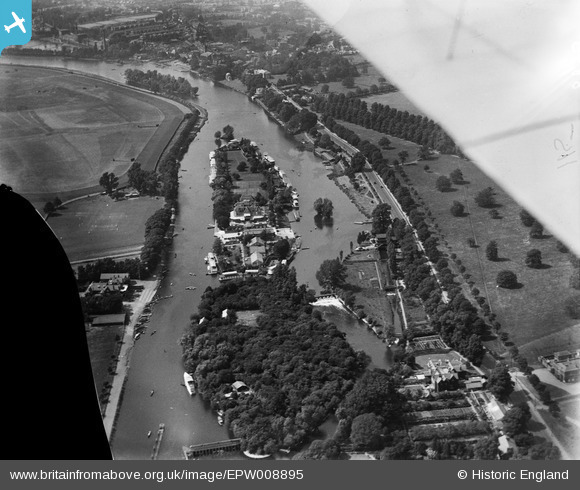
EPW008895 ENGLAND (1923). Taggs Island and Ash Island in the River Thames, Bushy Park, 1923
© Copyright OpenStreetMap contributors and licensed by the OpenStreetMap Foundation. 2026. Cartography is licensed as CC BY-SA.
Nearby Images (6)
EPW008895

EPW022845

EPW008894

EPW021886

EPW049597

EPW001714

Details
| Title | [EPW008895] Taggs Island and Ash Island in the River Thames, Bushy Park, 1923 |
| Reference | EPW008895 |
| Date | July-1923 |
| Link | |
| Place name | BUSHY PARK |
| Parish | |
| District | |
| Country | ENGLAND |
| Easting / Northing | 514774, 169040 |
| Longitude / Latitude | -0.34960162759126, 51.408260470937 |
| National Grid Reference | TQ148690 |
Pins

jill |
Sunday 21st of February 2016 04:41:07 PM | |
|
Pip |
Friday 3rd of January 2014 01:21:33 AM | |
|
Pip |
Thursday 2nd of January 2014 12:26:14 PM | |
|
Pip |
Thursday 2nd of January 2014 12:25:21 PM | |
|
Pip |
Thursday 2nd of January 2014 12:20:55 PM | |
|
Pip |
Thursday 2nd of January 2014 12:19:24 PM | |
|
Pip |
Thursday 2nd of January 2014 12:18:34 PM | |
|
loweightes |
Tuesday 27th of August 2013 05:30:50 PM | |
|
loweightes |
Tuesday 27th of August 2013 05:29:46 PM |