
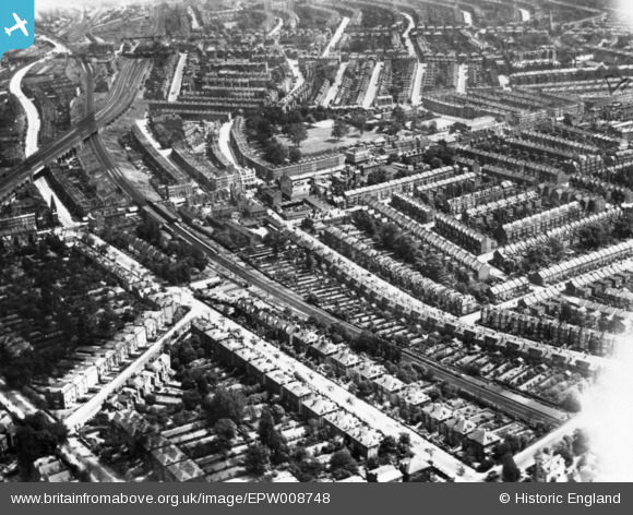
EPW008748 ENGLAND (1923). Dyne Road, Kilburn Grange Park and environs, Kilburn, 1923. This image has been produced from a print.
© Copyright OpenStreetMap contributors and licensed by the OpenStreetMap Foundation. 2026. Cartography is licensed as CC BY-SA.
Nearby Images (3)
EPW008748

EPW005999

EPW052780

Details
| Title | [EPW008748] Dyne Road, Kilburn Grange Park and environs, Kilburn, 1923. This image has been produced from a print. |
| Reference | EPW008748 |
| Date | 1923 |
| Link | |
| Place name | KILBURN |
| Parish | |
| District | |
| Country | ENGLAND |
| Easting / Northing | 524685, 184326 |
| Longitude / Latitude | -0.20176215622186, 51.54356010972 |
| National Grid Reference | TQ247843 |
Pins

Saul Marks |
Tuesday 26th of May 2026 02:00:03 AM | |
|
Leslie B |
Thursday 5th of May 2022 10:32:17 AM | |
|
Leslie B |
Thursday 5th of May 2022 10:30:18 AM | |
|
Leslie B |
Thursday 5th of May 2022 10:29:41 AM | |
 |
Leslie B |
Thursday 5th of May 2022 10:27:58 AM |
|
Leslie B |
Thursday 5th of May 2022 10:19:38 AM | |
|
Leslie B |
Thursday 5th of May 2022 10:18:25 AM | |
|
Leslie B |
Thursday 5th of May 2022 10:15:07 AM | |
 |
Leslie B |
Thursday 5th of May 2022 10:06:18 AM |
 |
Leslie B |
Monday 16th of August 2021 10:12:24 AM |
|
John Wass |
Monday 26th of December 2016 08:46:32 PM |