
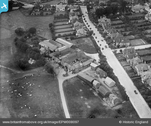
EPW008097 ENGLAND (1922). College Farm, Finchley, 1922
© Copyright OpenStreetMap contributors and licensed by the OpenStreetMap Foundation. 2026. Cartography is licensed as CC BY-SA.
Nearby Images (5)
EPW008097

EPW008099

EPW007984

EPW008096

EPW007985

Details
| Title | [EPW008097] College Farm, Finchley, 1922 |
| Reference | EPW008097 |
| Date | 6-September-1922 |
| Link | |
| Place name | FINCHLEY |
| Parish | |
| District | |
| Country | ENGLAND |
| Easting / Northing | 524547, 189806 |
| Longitude / Latitude | -0.20180872117476, 51.592844686413 |
| National Grid Reference | TQ245898 |
