
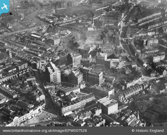
EPW007528 ENGLAND (1922). The J. and H. Robinson Ltd Flour and Corn Mills, Deptford, 1921. This image has been produced from a print.
© Copyright OpenStreetMap contributors and licensed by the OpenStreetMap Foundation. 2026. Cartography is licensed as CC BY-SA.
Nearby Images (18)
EPW007528

EAW043426

EAW043431

EAW043432

EAW043429

EAW043430

EAW043428

EAW043425

EAW043427

EAW025302

EAW025298

EAW025300

EAW025304

EAW025299

EAW025301

EAW025305

EAW025303

EAW025306

Details
| Title | [EPW007528] The J. and H. Robinson Ltd Flour and Corn Mills, Deptford, 1921. This image has been produced from a print. |
| Reference | EPW007528 |
| Date | 10-February-1922 |
| Link | |
| Place name | DEPTFORD |
| Parish | |
| District | |
| Country | ENGLAND |
| Easting / Northing | 537494, 177039 |
| Longitude / Latitude | -0.019982865438225, 51.475095396666 |
| National Grid Reference | TQ375770 |
Pins

SimonStenhouse |
Wednesday 5th of March 2025 02:00:44 PM | |
|
Leslie B |
Sunday 20th of February 2022 06:49:33 PM | |
|
John W |
Saturday 7th of May 2016 03:44:12 PM | |
|
John W |
Saturday 7th of May 2016 03:38:42 PM | |

Class31 |
Saturday 7th of May 2016 08:46:42 AM | |
|
Class31 |
Saturday 7th of May 2016 08:40:48 AM | |
|
Class31 |
Saturday 7th of May 2016 08:34:59 AM | |
|
Class31 |
Saturday 7th of May 2016 08:33:43 AM |


User Comment Contributions

Greenwich Station, 05/05/2016 |
Class31 |
Saturday 7th of May 2016 08:37:02 AM |