
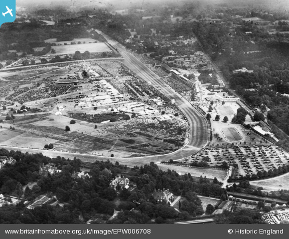
EPW006708 ENGLAND (1921). Ascot, Royal Ascot, 1921. This image has been produced from a print.
© Copyright OpenStreetMap contributors and licensed by the OpenStreetMap Foundation. 2026. Cartography is licensed as CC BY-SA.
Nearby Images (25)
EPW006708

EAW022115

EPW006700

EAW042137

EAW022114

EPW013401

EAW022117

EPW026284

EPW013441

EPW006707

EPW006706

EPW008715

EPW006702

EPW008705

EPW008709

EPW036160

EPW008716

EPW008704

EPW026285

EPW026290

EPW006704

EPW008707

EAW022116

EAW026661

EPW026288

Details
| Title | [EPW006708] Ascot, Royal Ascot, 1921. This image has been produced from a print. |
| Reference | EPW006708 |
| Date | June-1921 |
| Link | |
| Place name | ASCOT |
| Parish | SUNNINGHILL AND ASCOT |
| District | |
| Country | ENGLAND |
| Easting / Northing | 491839, 169102 |
| Longitude / Latitude | -0.67927461971826, 51.412997206872 |
| National Grid Reference | SU918691 |
Pins
Be the first to add a comment to this image!