
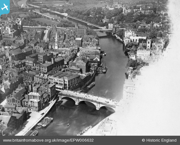
EPW006632 ENGLAND (1921). Ouse Bridge to Lendal Bridge, York, 1921. This image has been produced from a copy-negative affected by flare.
© Copyright OpenStreetMap contributors and licensed by the OpenStreetMap Foundation. 2026. Cartography is licensed as CC BY-SA.
Nearby Images (2)
EPW006632

EAW002152

Details
| Title | [EPW006632] Ouse Bridge to Lendal Bridge, York, 1921. This image has been produced from a copy-negative affected by flare. |
| Reference | EPW006632 |
| Date | June-1921 |
| Link | |
| Place name | YORK |
| Parish | |
| District | |
| Country | ENGLAND |
| Easting / Northing | 460149, 451717 |
| Longitude / Latitude | -1.0832141652465, 53.957844421682 |
| National Grid Reference | SE601517 |


