
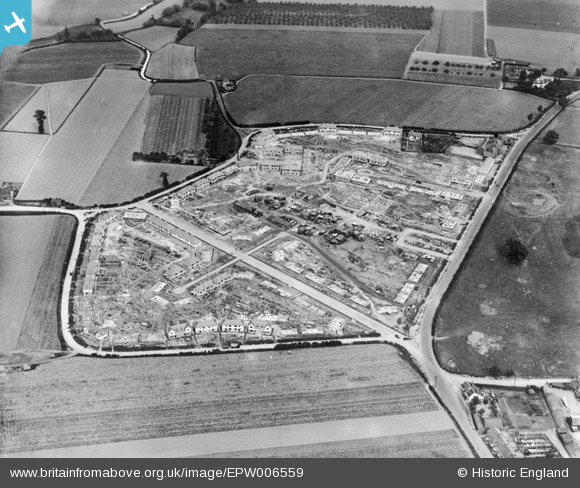
EPW006559 ENGLAND (1921). A new housing estate under construction at Marsh Green, Dagenham, 1921
© Copyright OpenStreetMap contributors and licensed by the OpenStreetMap Foundation. 2026. Cartography is licensed as CC BY-SA.
Nearby Images (13)
EPW006559

EPW005339

EPW006557

EPW005340

EPW006556

EPW005343

EPW005338

EPW006558

EPW005341

EPW005342

EAW026138

EAW026158

EPW035589

Details
| Title | [EPW006559] A new housing estate under construction at Marsh Green, Dagenham, 1921 |
| Reference | EPW006559 |
| Date | 7-June-1921 |
| Link | |
| Place name | DAGENHAM |
| Parish | |
| District | |
| Country | ENGLAND |
| Easting / Northing | 549258, 183682 |
| Longitude / Latitude | 0.15211572082406, 51.531808835106 |
| National Grid Reference | TQ493837 |
Pins

Ken Stanton |
Monday 8th of July 2019 05:54:29 PM | |
|
Ken Stanton |
Monday 8th of July 2019 05:53:10 PM | |
|
Ken Stanton |
Monday 8th of July 2019 05:52:37 PM | |
|
Ken Stanton |
Monday 8th of July 2019 05:51:53 PM | |
|
Ken Stanton |
Monday 8th of July 2019 05:50:10 PM | |
|
Ken Stanton |
Monday 8th of July 2019 05:49:09 PM | |
|
Ken Stanton |
Monday 8th of July 2019 05:48:43 PM | |
|
Ken Stanton |
Monday 8th of July 2019 05:47:45 PM | |
|
Ken Stanton |
Monday 8th of July 2019 05:46:43 PM | |
|
Martin |
Monday 10th of February 2014 11:07:35 AM |