
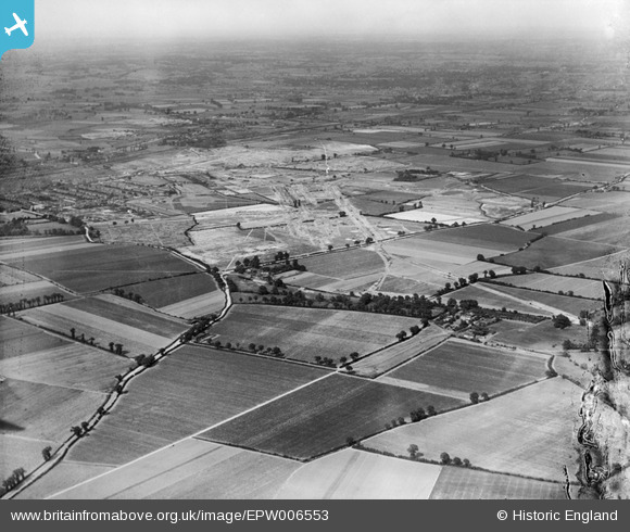
EPW006553 ENGLAND (1921). A new housing estate under construction, Chadwell Heath, from the south-west, 1921
© Copyright OpenStreetMap contributors and licensed by the OpenStreetMap Foundation. 2026. Cartography is licensed as CC BY-SA.
Nearby Images (5)
EPW006553

EAW043573

EPW036486

EPW036481

EPW036476

Details
| Title | [EPW006553] A new housing estate under construction, Chadwell Heath, from the south-west, 1921 |
| Reference | EPW006553 |
| Date | 7-June-1921 |
| Link | |
| Place name | CHADWELL HEATH |
| Parish | |
| District | |
| Country | ENGLAND |
| Easting / Northing | 545943, 185206 |
| Longitude / Latitude | 0.10498459049859, 51.546370826994 |
| National Grid Reference | TQ459852 |
Pins

Hermann the German |
Monday 30th of June 2014 03:25:38 PM | |
|
Hermann the German |
Monday 30th of June 2014 03:24:52 PM | |
|
mardell8 |
Monday 28th of October 2013 06:20:14 PM | |
|
mardell8 |
Monday 28th of October 2013 06:12:59 PM | |
|
mardell8 |
Monday 28th of October 2013 06:11:22 PM |