
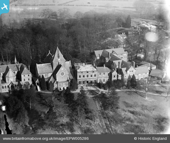
EPW005286 ENGLAND (1921). St Mary's Abbey and School, Mill Hill, 1921
© Copyright OpenStreetMap contributors and licensed by the OpenStreetMap Foundation. 2026. Cartography is licensed as CC BY-SA.
Nearby Images (5)
EPW005286

EPW005284

EPW005287

EPW005285

EPW005283

Details
| Title | [EPW005286] St Mary's Abbey and School, Mill Hill, 1921 |
| Reference | EPW005286 |
| Date | January-1921 |
| Link | |
| Place name | MILL HILL |
| Parish | |
| District | |
| Country | ENGLAND |
| Easting / Northing | 522151, 193091 |
| Longitude / Latitude | -0.23523923453811, 51.62289521371 |
| National Grid Reference | TQ222931 |
Pins
Be the first to add a comment to this image!