
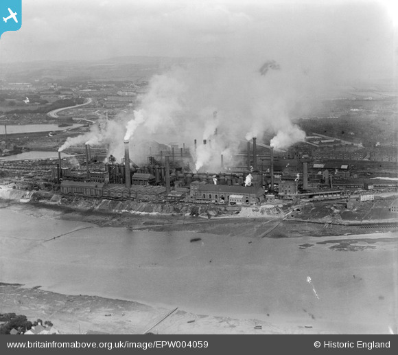
EPW004059 ENGLAND (1920). Barrow Haematite Iron and Steel Works, Barrow-in-Furness, from the west, 1920
© Copyright OpenStreetMap contributors and licensed by the OpenStreetMap Foundation. 2026. Cartography is licensed as CC BY-SA.
Nearby Images (2)
EPW004059

EPW004071

Details
| Title | [EPW004059] Barrow Haematite Iron and Steel Works, Barrow-in-Furness, from the west, 1920 |
| Reference | EPW004059 |
| Date | July-1920 |
| Link | |
| Place name | BARROW-IN-FURNESS |
| Parish | |
| District | |
| Country | ENGLAND |
| Easting / Northing | 318651, 469992 |
| Longitude / Latitude | -3.2447389740173, 54.119173744378 |
| National Grid Reference | SD187700 |
Pins

Matthew Culley |
Sunday 29th of March 2020 02:27:15 PM | |
|
Robert - Cumbria |
Friday 14th of March 2014 09:49:07 AM | |
|
Robert - Cumbria |
Friday 14th of March 2014 09:32:23 AM | |
|
Robert - Cumbria |
Friday 14th of March 2014 09:30:29 AM | |
|
Robert - Cumbria |
Friday 14th of March 2014 09:26:15 AM | |
|
Robert - Cumbria |
Friday 14th of March 2014 09:24:06 AM | |
|
Robert - Cumbria |
Friday 14th of March 2014 09:24:00 AM | |
|
steve |
Tuesday 11th of December 2012 08:21:27 PM |
User Comment Contributions

Just look at that pollution ! |
oversands |
Tuesday 11th of December 2012 05:57:58 PM |