
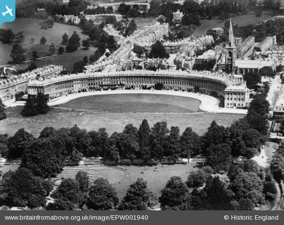
EPW001940 ENGLAND (1920). The Royal Crescent, Bath, 1920. This image has been produced from a copy-negative.
© Copyright OpenStreetMap contributors and licensed by the OpenStreetMap Foundation. 2026. Cartography is licensed as CC BY-SA.
Nearby Images (9)
EPW001940

EPW001949

EPW048395

EPW048394

EAW026454

EPW053142

EAW026453

EAW027311

EPW033155

Details
| Title | [EPW001940] The Royal Crescent, Bath, 1920. This image has been produced from a copy-negative. |
| Reference | EPW001940 |
| Date | July-1920 |
| Link | |
| Place name | BATH |
| Parish | |
| District | |
| Country | ENGLAND |
| Easting / Northing | 374457, 165372 |
| Longitude / Latitude | -2.3671104926373, 51.386320538187 |
| National Grid Reference | ST745654 |
Pins
Be the first to add a comment to this image!