
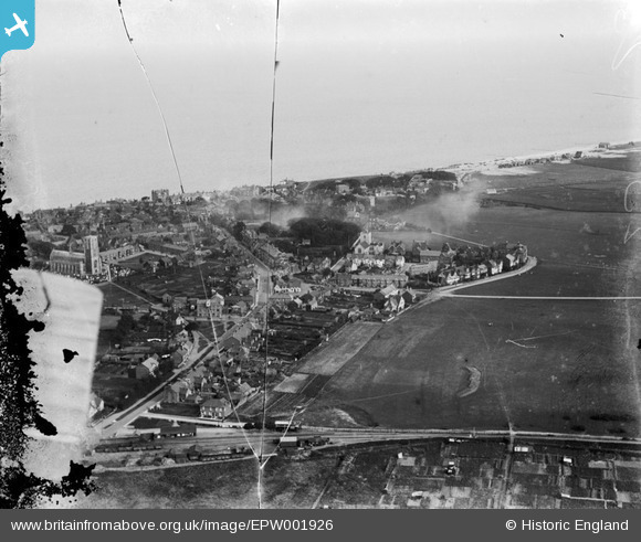
EPW001926 ENGLAND (1920). General view of Southwold, Southwold, from the north, 1920
© Copyright OpenStreetMap contributors and licensed by the OpenStreetMap Foundation. 2026. Cartography is licensed as CC BY-SA.
Nearby Images (2)
EPW001926

EPW001927

Details
| Title | [EPW001926] General view of Southwold, Southwold, from the north, 1920 |
| Reference | EPW001926 |
| Date | June-1920 |
| Link | |
| Place name | SOUTHWOLD |
| Parish | SOUTHWOLD |
| District | |
| Country | ENGLAND |
| Easting / Northing | 650458, 276507 |
| Longitude / Latitude | 1.6762978602272, 52.328992916839 |
| National Grid Reference | TM505765 |
Pins

bugbear |
Thursday 24th of October 2013 02:42:48 PM | |

Class31 |
Monday 9th of July 2012 10:18:35 PM | |
|
Class31 |
Monday 9th of July 2012 10:17:19 PM | |
|
Class31 |
Monday 9th of July 2012 10:16:47 PM | |
|
Class31 |
Monday 9th of July 2012 10:16:24 PM | |
Southwold Railway - 3ft gauge - opened 24/9/1879, closed 11/4/1929. |
mannidaze |
Wednesday 26th of March 2014 05:47:46 PM |
|
Class31 |
Monday 9th of July 2012 10:16:23 PM |
User Comment Contributions
Wonderful to see a photo of the Southwold Railway which closed in 1929. |
Class31 |
Monday 9th of July 2012 10:22:23 PM |