
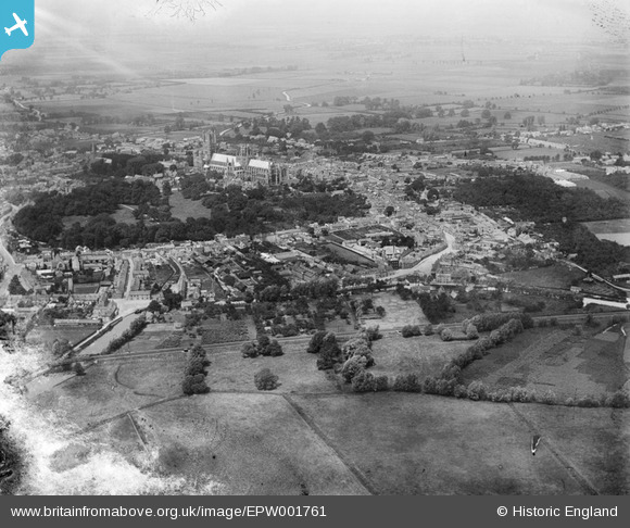
EPW001761 ENGLAND (1920). Ely Cathedral and area, Ely, 1920
© Copyright OpenStreetMap contributors and licensed by the OpenStreetMap Foundation. 2026. Cartography is licensed as CC BY-SA.
Nearby Images (2)
EPW001761

EPW001782

Details
| Title | [EPW001761] Ely Cathedral and area, Ely, 1920 |
| Reference | EPW001761 |
| Date | June-1920 |
| Link | |
| Place name | ELY |
| Parish | ELY |
| District | |
| Country | ENGLAND |
| Easting / Northing | 554410, 279999 |
| Longitude / Latitude | 0.26965587293695, 52.39581906309 |
| National Grid Reference | TL544800 |
Pins

chiffchaffbirdy |
Friday 14th of December 2018 03:09:18 PM | |
|
Middlepeak |
Tuesday 30th of January 2018 11:07:35 PM | |
|
Middlepeak |
Tuesday 30th of January 2018 11:06:35 PM | |
|
Middlepeak |
Tuesday 30th of January 2018 11:05:10 PM | |
|
chiffchaffbirdy |
Tuesday 19th of February 2013 04:33:56 PM | |
|
chiffchaffbirdy |
Tuesday 19th of February 2013 04:31:58 PM | |
|
Chells809 |
Thursday 14th of February 2013 10:01:26 PM | |
|
Chells809 |
Thursday 14th of February 2013 09:58:36 PM | |

Class31 |
Saturday 6th of October 2012 07:57:49 PM | |
|
Class31 |
Saturday 6th of October 2012 07:50:37 PM | |
|
Class31 |
Saturday 6th of October 2012 07:48:46 PM | |
|
Class31 |
Saturday 6th of October 2012 07:47:40 PM | |
|
Class31 |
Saturday 6th of October 2012 07:45:46 PM | |
|
Class31 |
Saturday 6th of October 2012 07:42:33 PM | |
|
Class31 |
Saturday 6th of October 2012 07:41:48 PM | |
|
Class31 |
Saturday 6th of October 2012 07:40:16 PM |