
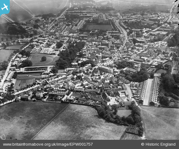
EPW001757 ENGLAND (1920). Wellington Street, Newmarket, 1920
© Copyright OpenStreetMap contributors and licensed by the OpenStreetMap Foundation. 2026. Cartography is licensed as CC BY-SA.
Nearby Images (4)
EPW001757

EAW037281

EPW001754

EPW049263

Details
| Title | [EPW001757] Wellington Street, Newmarket, 1920 |
| Reference | EPW001757 |
| Date | June-1920 |
| Link | |
| Place name | NEWMARKET |
| Parish | NEWMARKET |
| District | |
| Country | ENGLAND |
| Easting / Northing | 564182, 263502 |
| Longitude / Latitude | 0.40510682411079, 52.244777883323 |
| National Grid Reference | TL642635 |
Pins

Bedford1944 |
Thursday 6th of February 2014 08:52:53 PM |