
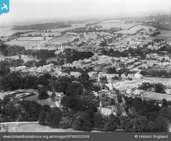
EPW001569 ENGLAND (1920). General view of the town, Hemel Hempstead, from the south-west, 1920
© Copyright OpenStreetMap contributors and licensed by the OpenStreetMap Foundation. 2026. Cartography is licensed as CC BY-SA.
Nearby Images (7)
EPW001569

EAW048443

EAW048443
EAW048447

EAW048445

EAW048445
EPW022456

Details
| Title | [EPW001569] General view of the town, Hemel Hempstead, from the south-west, 1920 |
| Reference | EPW001569 |
| Date | June-1920 |
| Link | |
| Place name | HEMEL HEMPSTEAD |
| Parish | |
| District | |
| Country | ENGLAND |
| Easting / Northing | 505104, 207256 |
| Longitude / Latitude | -0.47715517641842, 51.753667887647 |
| National Grid Reference | TL051073 |
Pins

H.E. |
Tuesday 7th of April 2015 04:27:36 PM | |
|
H.E. |
Monday 12th of January 2015 06:27:41 PM | |
|
okthen |
Thursday 17th of October 2013 09:29:43 AM |