
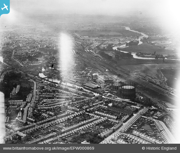
EPW000869 ENGLAND (1920). View over Reading Gas Works and railway, Reading, from the east, 1920
© Copyright OpenStreetMap contributors and licensed by the OpenStreetMap Foundation. 2024. Cartography is licensed as CC BY-SA.
Nearby Images (5)
EPW000869

EPW037496

EPW037499

EPW000873

EPW037498

Details
| Title | [EPW000869] View over Reading Gas Works and railway, Reading, from the east, 1920 |
| Reference | EPW000869 |
| Date | May-1920 |
| Link | |
| Place name | READING |
| Parish | |
| District | |
| Country | ENGLAND |
| Easting / Northing | 473003, 173493 |
| Longitude / Latitude | -0.94919212704813, 51.45521604755 |
| National Grid Reference | SU730735 |
Pins
 Class31 |
Wednesday 10th of June 2015 09:00:44 PM | |
Class31 |
Wednesday 10th of June 2015 08:58:44 PM | |
Class31 |
Wednesday 10th of June 2015 08:52:38 PM | |
 chainbull |
Tuesday 25th of November 2014 09:40:23 AM | |
Class31 |
Wednesday 28th of May 2014 11:30:02 AM | |
Norman W |
Saturday 20th of October 2012 03:01:46 PM | |
Norman W |
Saturday 20th of October 2012 03:00:57 PM | |
Norman W |
Saturday 20th of October 2012 02:58:25 PM | |
Norman W |
Saturday 20th of October 2012 02:51:00 PM |


User Comment Contributions
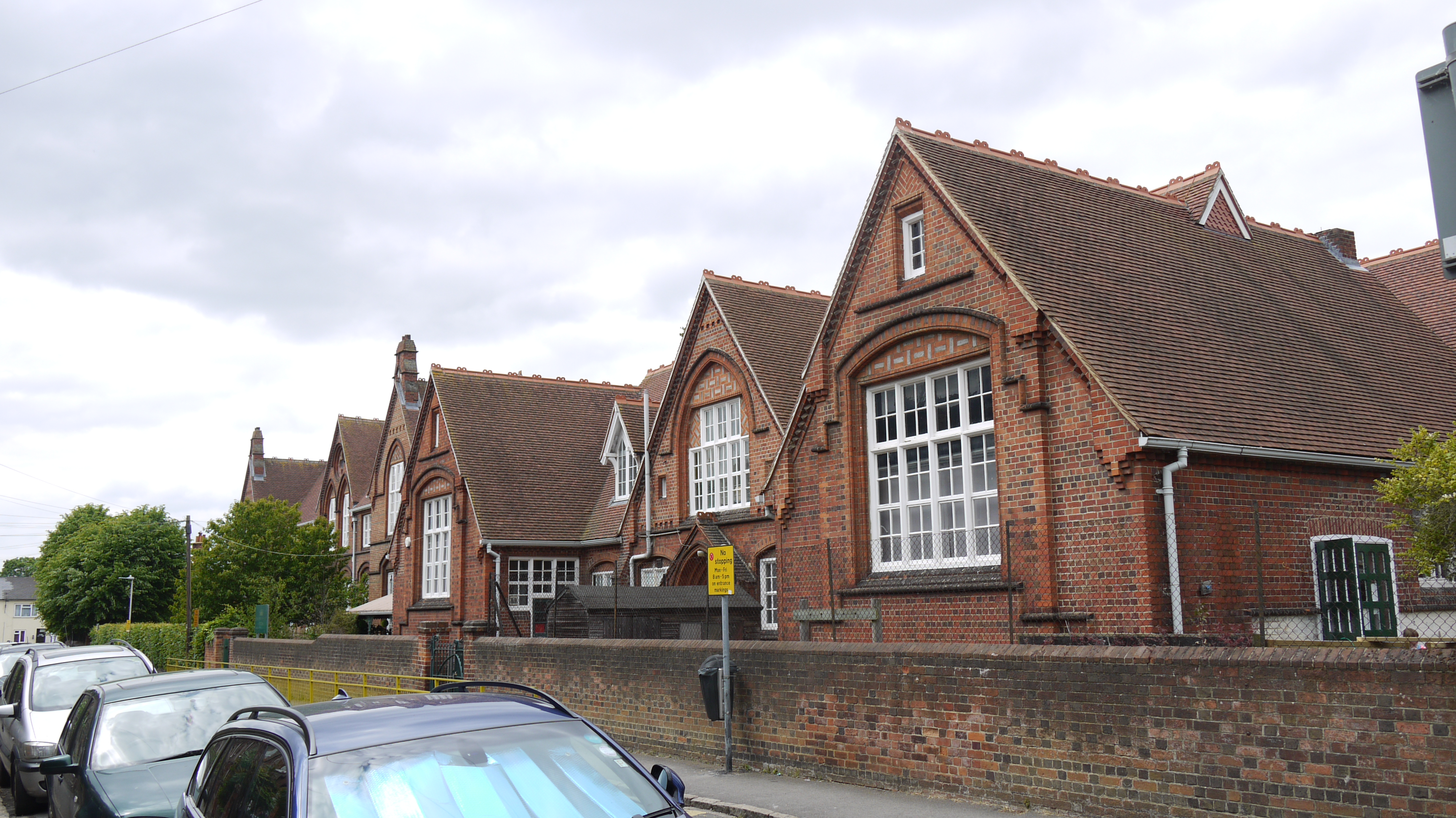 New Town Primary School, School Terrace, Reading, 10/06/2015 |
Class31 |
Wednesday 10th of June 2015 08:51:52 PM |


