
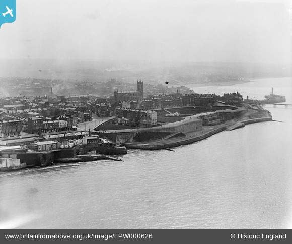
EPW000626 ENGLAND (1920). Fort Green, Margate, from the north-east, 1920
© Copyright OpenStreetMap contributors and licensed by the OpenStreetMap Foundation. 2026. Cartography is licensed as CC BY-SA.
Nearby Images (11)
EPW000626

EPW039328

EPW039329

EPW042852
, Cliftonville, 1933")
EPW009239

EPW035474

EPW035468

EPW048848

EPW042849

EPW000638

EPW035470

Details
| Title | [EPW000626] Fort Green, Margate, from the north-east, 1920 |
| Reference | EPW000626 |
| Date | April-1920 |
| Link | |
| Place name | MARGATE |
| Parish | |
| District | |
| Country | ENGLAND |
| Easting / Northing | 635891, 171443 |
| Longitude / Latitude | 1.3911675134352, 51.392408572857 |
| National Grid Reference | TR359714 |
Pins
Be the first to add a comment to this image!