
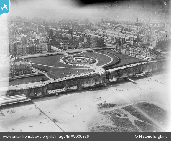
EPW000326 ENGLAND (1920). The Oval, Margate, 1920
© Copyright OpenStreetMap contributors and licensed by the OpenStreetMap Foundation. 2026. Cartography is licensed as CC BY-SA.
Nearby Images (7)
EPW000326

EPW035471

EPW000618

EPW000628

EPW000617

EPW000616

EPW052888

Details
| Title | [EPW000326] The Oval, Margate, 1920 |
| Reference | EPW000326 |
| Date | April-1920 |
| Link | |
| Place name | MARGATE |
| Parish | |
| District | |
| Country | ENGLAND |
| Easting / Northing | 636477, 171342 |
| Longitude / Latitude | 1.3995086646743, 51.391258024208 |
| National Grid Reference | TR365713 |
Pins
Be the first to add a comment to this image!