
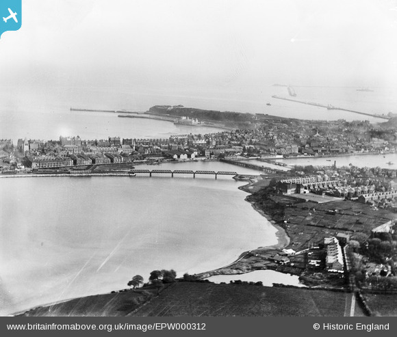
EPW000312 ENGLAND (1920). Weymouth, from the north-west, 1920
© Copyright OpenStreetMap contributors and licensed by the OpenStreetMap Foundation. 2026. Cartography is licensed as CC BY-SA.
Nearby Images (2)
EPW000312

EPW013678

Details
| Title | [EPW000312] Weymouth, from the north-west, 1920 |
| Reference | EPW000312 |
| Date | April-1920 |
| Link | |
| Place name | WEYMOUTH |
| Parish | |
| District | |
| Country | ENGLAND |
| Easting / Northing | 367589, 79535 |
| Longitude / Latitude | -2.458149889601, 50.614038959427 |
| National Grid Reference | SY676795 |
Pins

gBr |
Thursday 8th of October 2015 09:07:40 PM | |
|
Mr |
Saturday 13th of July 2013 11:04:43 PM | |
|
Mr |
Saturday 13th of July 2013 11:03:09 PM | |

Class31 |
Friday 1st of March 2013 10:56:52 PM | |
|
Class31 |
Friday 1st of March 2013 10:48:00 PM | |
|
Class31 |
Friday 1st of March 2013 10:47:23 PM | |
|
Class31 |
Monday 1st of October 2012 04:41:04 PM | |
|
Class31 |
Monday 1st of October 2012 04:40:10 PM | |
|
Class31 |
Monday 1st of October 2012 04:39:27 PM | |
|
Class31 |
Monday 1st of October 2012 04:39:03 PM |