
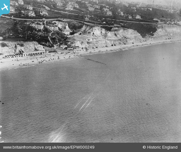
EPW000249 ENGLAND (1920). West Cliff, Bournemouth, 1920
© Copyright OpenStreetMap contributors and licensed by the OpenStreetMap Foundation. 2025. Cartography is licensed as CC BY-SA.
Nearby Images (7)
EPW000249

EPW000270

EPW041043

EPW018165

EPW000265

EPW013554

EPW018157

Details
| Title | [EPW000249] West Cliff, Bournemouth, 1920 |
| Reference | EPW000249 |
| Date | April-1920 |
| Link | |
| Place name | WEST CLIFF |
| Parish | |
| District | |
| Country | ENGLAND |
| Easting / Northing | 407464, 90064 |
| Longitude / Latitude | -1.8942775512526, 50.709587502176 |
| National Grid Reference | SZ075901 |
Pins
Be the first to add a comment to this image!
User Comment Contributions
Durley Chine 25/01/2014 |

Class31 |
Monday 27th of January 2014 02:35:00 PM |