
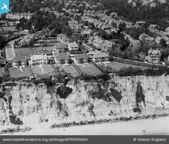
EPR000666 ENGLAND (1935). Residential properties around Sandbourne Road and Alumhurst Road, West Cliff, 1935
© Copyright OpenStreetMap contributors and licensed by the OpenStreetMap Foundation. 2025. Cartography is licensed as CC BY-SA.
Nearby Images (4)
EPR000666

EPW018157

EPW041043

EPW000265

Details
| Title | [EPR000666] Residential properties around Sandbourne Road and Alumhurst Road, West Cliff, 1935 |
| Reference | EPR000666 |
| Date | 26-June-1935 |
| Link | |
| Place name | WEST CLIFF |
| Parish | |
| District | |
| Country | ENGLAND |
| Easting / Northing | 407157, 90098 |
| Longitude / Latitude | -1.8986253291402, 50.709897150313 |
| National Grid Reference | SZ072901 |
Pins
Be the first to add a comment to this image!