
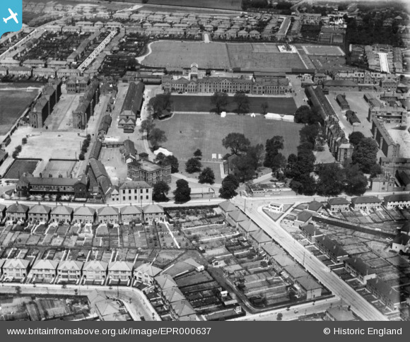
EPR000637 ENGLAND (1935). Hounslow Cavalry Barracks, Hounslow, 1935
© Copyright OpenStreetMap contributors and licensed by the OpenStreetMap Foundation. 2026. Cartography is licensed as CC BY-SA.
Nearby Images (6)
EPR000637

EPW023231

EPW023237

EPW023234

EPW023228

EPW057925

Details
| Title | [EPR000637] Hounslow Cavalry Barracks, Hounslow, 1935 |
| Reference | EPR000637 |
| Date | 9-June-1935 |
| Link | |
| Place name | HOUNSLOW |
| Parish | |
| District | |
| Country | ENGLAND |
| Easting / Northing | 511927, 175550 |
| Longitude / Latitude | -0.38846413433251, 51.467348352433 |
| National Grid Reference | TQ119756 |
Pins
Be the first to add a comment to this image!